Home / Survey & Mapping / Survey Applications

Survey Applications

Survey with confidence

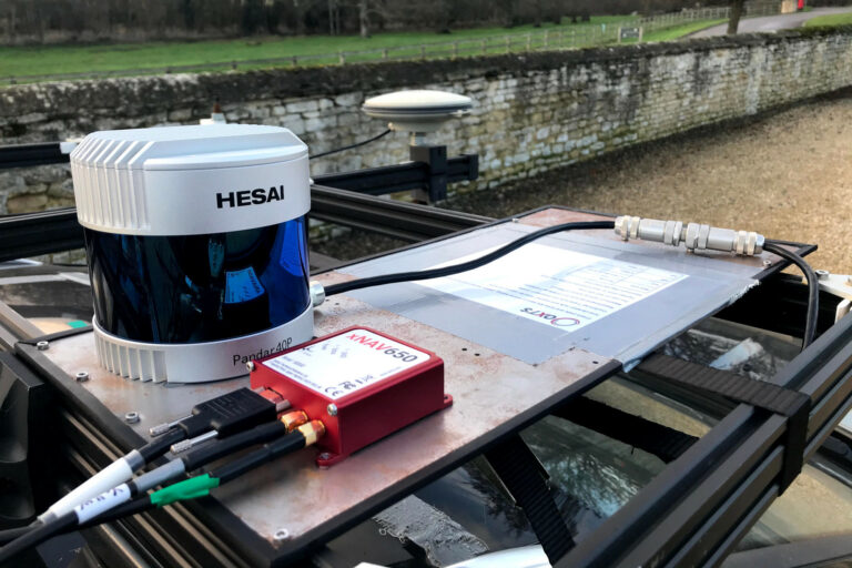
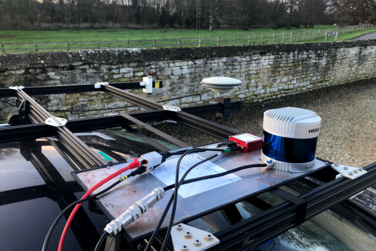
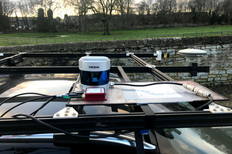
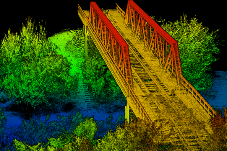
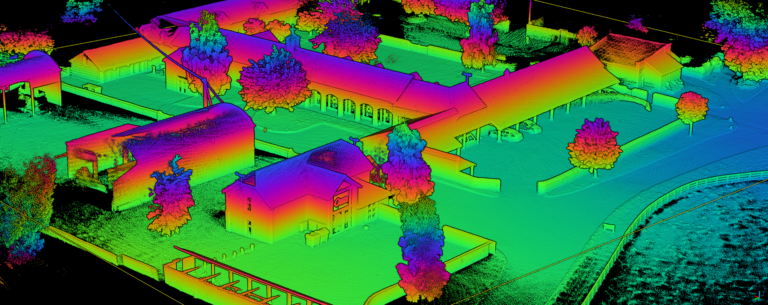
Geospatial information is a valuable commodity in the modern world, with more and more being collected for use in a wide range of industries. The most efficient way is with a mobile system which can cover wide areas in short periods of time.

Whether the mode of collection is land-based, aerial, or marine, the robust GNSS-aided inertial navigation systems (INS) from OxTS provide accurate georeferencing data around the world.

OxTS’ INS solutions are trusted by companies across a myriad of industries worldwide to capture precise measurements for survey and mapping applications.
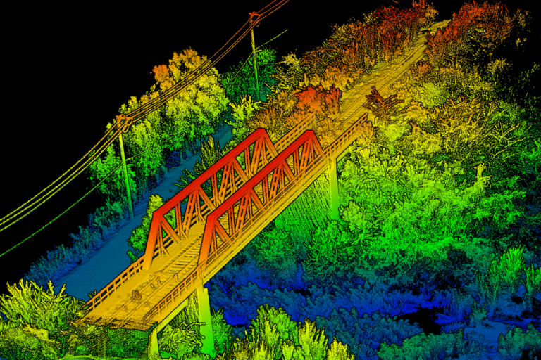
Complete Solution

Industrial Measurement Solutions offers the complete survey solution, from INS, survey device to post-processing software, to deliver navigation data into the hands of surveyors, enabling accurate and reliable georeferencing of geospatial data, with confidence, in all environments.

Proven inertial navigation solutions to help you capture the precise measurements you need for aerial mapping applications, again and again, time after time.

The integrated GNSS and inertial technologies of our solutions enable direct georeferencing in the air, increasing efficiency and streamlining the workflow.

Eliminate the necessity for ground control points (GCPs) and reduce sidelap requirements, saving time and effort and simplifying post-processing.

OxTS’ INS devices are suitable for long baseline mapping and offer excellent repeatability as well as accuracy

Typical areas of use:

  • Map creation
  • Geographic survey
  • Environment and agriculture monitoring
  • Filming

OxTS INS devices have been developed with LiDAR surveying in mind.

When considering hardware requirements for LiDAR surveying, getting the best navigation data is absolutely crucial. It will affect the resulting pointcloud – often more so than the choice of LiDAR equipment.

OxTS offers a range of suitable INS navigation devices that provide accurate and reliable inertial data for your LiDAR survey.

  • Navigation Data – Our INS devices output survey-grade navigation data that will give you accurate, centimetre-level absolute positioning so pointcloud surveying can be reliable and repeatable. Our IMU sensors offer orientation measurements that will maintain pointcloud accuracy at long distances.
  • Interfacing – As well as the traditional PPS, OxTS is proud to offer Precision Time Protocol (PTP) on all INS devices that allows for simple over-ethernet time synchronisation with compatible LiDAR sensors.
  • Georeferencing – We offer our georeferencing and calibration software, OxTS Georeferencer, which can georeference data between an OxTS INS and a compatible LiDAR into a finished pointcloud. It also offers the ability to calibrate the angles in your hardware setup and analyse the accuracy in every point of the cloud.
  • Confidence – OxTS has experience working with a range of LiDAR manufacturers covering all budgets and target applications.

Typical areas of use:

  • Exploration (pipelines, etc.)
  • Geographic survey
  • Agricultural monitoring and survey
  • Mining and construction monitoring

Our systems for mobile mapping seamlessly integrate GNSS with inertial measurements to generate accurate and consistent position, orientation, and heading.

The sensor fusion and tight-coupling allow data to be collected even in poor GNSS environments such as in forests or urban canyons.

Trajectory is recorded at up to 250 Hz and synchronised with LiDAR and other external imaging sensors. Once installed, our systems can be left to operate without needing repeat configuration or maintenance.

Typical areas of use:

  • Road and rail maintenance surveys
  • Autonomous driving and test environments
  • Infrastructure monitoring and city survey
  • Filming

We provide a range of one-box GNSS/INS solutions capable of measuring position, heading and orientation for direct georeferencing for commercial UAVs.

Our solutions are equipped with inputs and outputs that can be directly interfaced to remote sensing equipment while we also offer bespoke technology integration and consultancy with LiDAR OEMs and system integrators.

Check our supported LiDAR products here.

Typical areas of use:

  • Exploration
  • Filming
  • Mining and construction monitoring
  • Environment and agriculture monitoring
  • Geographic survey
  • Infrastructure monitoring and city survey

Application Videos